Yr Wyddfa via the Watkin Path
- Distance
- 14.4 km
- Elevation
- 1,238 m
- Duration
- 6h 00m
- Location
- Eryri
- Date
- 14 March 2026
The Watkin Path is no ordinary way up Yr Wyddfa. In 1892 it became the first officially designated footpath in Great Britain, opened by the then Prime Minister William Gladstone at the age of 83. That history gives the route a weight that goes beyond the climbing - you’re walking a path that helped establish the idea of public access to the mountains.
Route Map
Route Description
The Watkin Path and Gladstone Rock
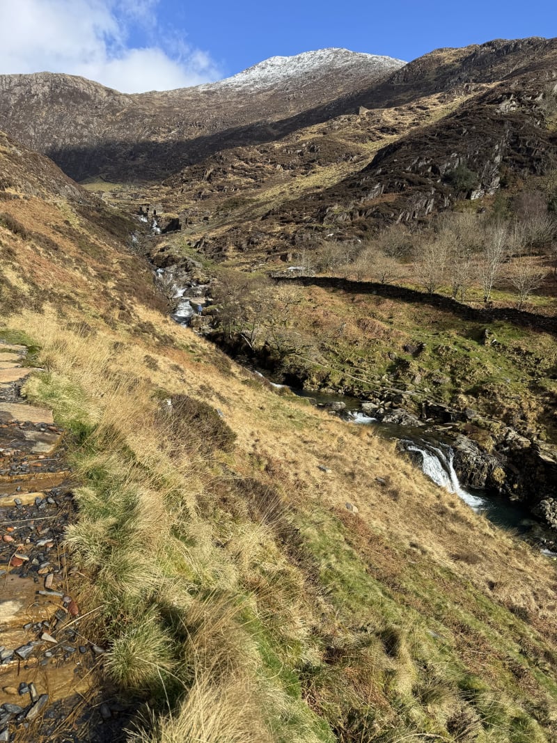
The route starts from the Bethania car park at the foot of Nant Gwynant and follows the broad, well-built lower path through oak woodland alongside the Afon Cwm Llan. The path was constructed by Sir Edward Watkin, a railway entrepreneur and early champion of public access to the countryside.
About halfway up, the path passes Gladstone Rock - a large flat boulder where William Gladstone addressed a crowd at the path’s opening ceremony. A plaque on the rock marks the occasion. It is a good spot to stop and take in the view back down the valley before the route steepens.
Upper Path and Summit
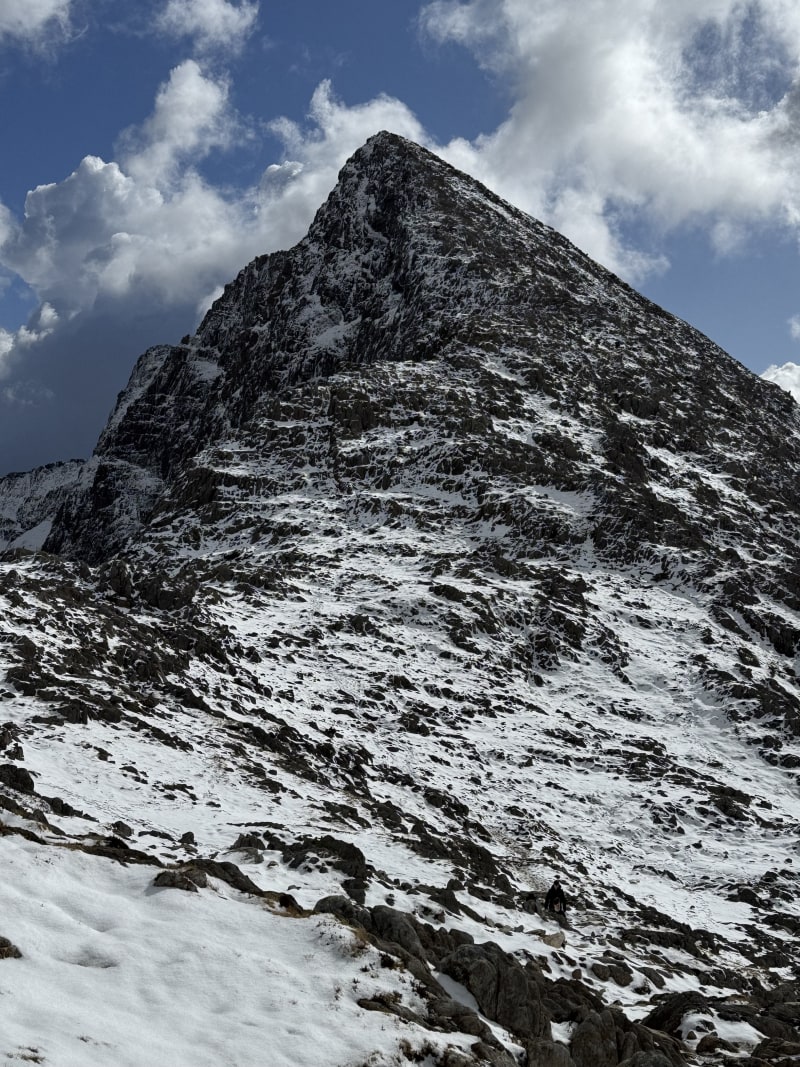
Above Gladstone Rock the character of the walk changes. The path climbs steeply through the old slate workings of Cwm Llan before hitting the exposed upper section. The final scramble up to the summit ridge is the hardest part of the Watkin Path - loose rock and steep ground that requires hands in places. In poor conditions this section demands care.
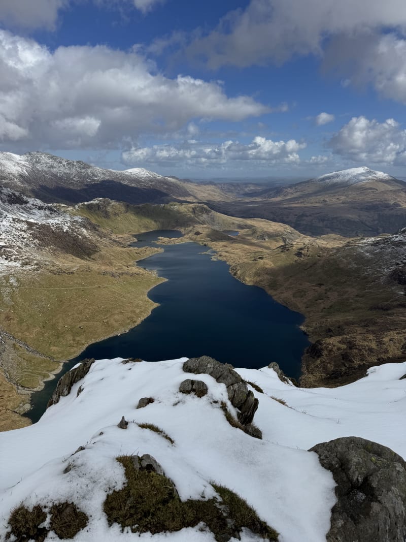
The summit of Yr Wyddfa (1,085 m) needs little introduction. On a clear day the views stretch from the Llyn Peninsula to the peaks of the Carneddau and the Glyderau.
Descent via the South Ridge
Rather than retracing the Watkin Path, I descended via the south ridge (Allt Maenderyn) - a fine alternative that turns the walk into a circular route. From the summit, the path follows the Rhyd Ddu path south-west before narrowing at Bwlch Main, where the ridge drops away steeply on both sides. The exposure here is brief but memorable.
Beyond Bwlch Main the ridge broadens over Clawdd Coch and the going eases, following a well-defined grassy path with views back to the summit and across to Y Lliwedd. The descent is steady and straightforward compared to the upper Watkin Path. At the base of the ridge, the route passes through the old slate quarry workings before joining the Hafod y Llan tramway and dropping back down to rejoin the Watkin Path near the waterfalls above Gladstone Rock.
Notes
- The Watkin Path is the most demanding of the main routes up Yr Wyddfa - the 1,238 m of elevation gain is more than any other path to the summit.
- The lower section through the woodland is sheltered and pleasant, but the upper section is fully exposed.
- Car parking at Bethania fills early on weekends - arriving before 9am is advisable.
- The Watkin Path was the first public footpath in Great Britain, opened by William Gladstone on 13 September 1892.